Bramham
West Yorkshire
The village is of ancient origin and was situated on an old Roman road from York towards Ilkley. In the Norman era, the Domesday Book in 1086 shows the village population to be larger than that of nearby Wetherby , which is now a considerably larger town.
The historic All Saints' Church in the village stands at the end of an Anglo Saxon oval churchyard. The present church has parts dating back to 1150, but was extended in the 13th century and given a major restoration in the 1850s with some further work following a fire in 1874.
At Camp Hill, just outside the village, the Battle of Bramham Moor took place on February 19, 1408, the last act of rebellion of Henry Percy, first Earl of Northumberland, who died in the battle against a local force loyal to usurper king Henry IV, led by High Sheriff of Yorkshire Sir Thomas Rokeby.
To the south east of the village is Bramham Park, a large private country estate, which is notably host to Yorkshire's largest equestrian event the Bramham International Horse Trials, in June, and the Leeds Festival music festival, in August.
Find out more about Bramham history at the  Historic Bramham
Historic Bramham  Village features
 Bramham has an old parish church.
 Bramham has pubs.
  Bramham has a shop.
  The village has a Post Office.
 Bramham has a village hall.
  Bramham has a school.
 Place of worship: Anglican.
 Travel
Bus travel
The village has bus services to neighbouring towns and villages and city centres.  Road travel
Bramham is reached on minor roads - about 2 miles from A1(M) J44 or J45. Places to visit
 Harewood House
HarewoodMore information can be found at the
 Harewood website.
Locate on map:
 Harewood House
  Spofforth Castle
off Castle Street, SpofforthSpofforth Castle is the ruins of a fortified manor house about 6 miles by the A661 road to the south-west of Harrogate. William the Conqueror granted Spofforth to William de Percy, a favourite who was granted many estates in Yorkshire. A manor was built and extended through the 13th century by later generations of the Percy family. It is reputed that the Magna Carta was drawn up there in 1215. Although the Percy family made Alnwick Castle, in Northumberland, their base from early in the 14th century, Spofforth remained within the family and underwent some remodelling in the early to mid 15th century. In the War of the Roses, the Percy family supported The House of Lancaster and the castle was wrecked by Yorkists who had gained victory in the 1461 Battle of Towton in which Henry Percy, Earl of Northumberland was killed. There was some 16th century restoration, but it was reduced to ruins around the time of the Civil War. The site is free to enter and managed by English Heritage.
Further details at the English Heritage - Spofforth Castle website.
English Heritage - Spofforth Castle Find on map: Spofforth Castle
Spofforth Castle  Roundhay Park and Tropical World
Prince's Avenue, RoundhayRoundhay Park is a popular large park 3 miles north of Leeds city centre, owned by Leeds City Council, with more than 280 hectares of parkland, woodland, lakes and gardens. It also has cafes and is the location of Tropical World, which holds a large collection of tropical plants, birds and reptiles, a butterfly house, aquariums and other animal enclosures, including the ever-popular meerkats.
Find out more at this
Leeds City Council - Roundhay Park Otley Chevin Country Park
The Otley Chevin Country Park is a forested hillside with rocky outcrops offering magnificent views across Otley and the Wharfe Valley, a network of paths to explore, a variety of wildlife and some interesting tree sculptures. The Chevin is an area with strong evidence of hunting in the stone age with thousands of flint arrowheads and knives having been found there. Cup and ring marked rocks dating from the bronze age are scheduled ancient monuments. Two areas of an iron age settlement were discovered in the 1960s and an archaelogical dig in the 1990s found evidence of a hut circle within a rubble enclosure. Much of the forestry in the area was planted in the 1950s and 1960s and it became a local nature reserve in 1989. There are car parks with access to the country park at East Chevin Road and Yorkgate.
Further information can be found at the
Leeds City Council - Otley Chevin Country Park Friends of Chevin Forest  Nidderdale Area of Outstanding Natural Beauty
Extending across an area of 232 square miles (600 sq km), the Nidderdale Area of Outstanding Beauty starts at the edge of Otley . The area has a beautiful and varied landscape including rolling heather-topped moorland, stone-walled agricultural fields and farms, small villages, lake-like reservoirs and some outstanding geological features, the best known of which are Brimham Rocks. For more details see our Nidderdale page. Emergency services
West Yorkshire Police West Yorkshire Police West Yorkshire Fire and Rescue Service
West Yorkshire Fire and Rescue Service Yorkshire Ambulance Service NHS Trust
Yorkshire Ambulance Service NHS Trust  Local government
Civil parish council
Bramham Parish CouncilProvides some local services in the area.
Link to council website:
Bramham Parish Council Metropolitan district council
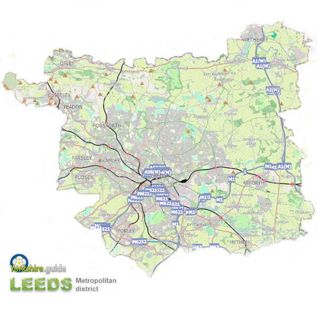 City of Leeds
The City of Leeds authority covers an area extending several miles beyond the city itself, including areas of agricutural land with widely spaced villages to the north east and several separate small towns including Garforth , Guiseley , Morley , Otley , Pudsey , Rothwell , Wetherby and Yeadon .
Leeds is just one of a ring five metropolitan councils covering the many cities, towns and villages of the conurbation of West Yorkshire. Around one-third of the West Yorkshire population live in the Leeds metropolitan district, just over ¾ million at the time of the 2011 census.
In the City of Leeds metropolitan district a total of 99 councillors are elected. There are three councillors per ward across 33 wards. Councillors are usually elected for four-year terms, one councillor being elected in each of three years out of four. A Lord Mayor of Leeds is elected from the council each year.
External link to Leeds City Council website.
Leeds City Council Political composition after May 2026 election:
99 members
Political composition after May 2023 election:
99 members
 See our Yorkshire.guide Gazetteer for more about the
  Leeds metropolitan district and places within it.
County strategic authority
West Yorkshire Combined AuthorityCovers some combined services of the five metropolitan district councils of
 Bradford ,
  Calderdale , Leeds ,
  Kirklees and
  Wakefield — which were at one time provided by a West Yorkshire metropolitan county council, with the addition of the non-contiguous unitary authority area of the City of
  York council as well as the unelected Leeds City Region Enterprise Partnership. Since 2021 it has operated with an elected mayor as chairman and decision-maker for some responsibilities. These include transport, housing and planning and finance powers. The responsibilities also include those of Police and Crime Commissioner, a role substantially delegated to an appointee deputy mayor.
 Elected mayor:
West Yorkshire Combined Authority Police and Crime Commissioner
The Police and Crime Commissioner for West YorkshireThis role has become one of the many responsibilities of the West Yorkshire elected mayor since May 2021.
West Yorkshire Combined Authority Fire Authority
West Yorkshire Fire AuthorityThe fire authority is made up of elected members of each of the five metropolitan district councils of West Yorkshire - Bradford, Calderdale, Leeds, Kirklees and Wakefield.
West Yorkshire Fire Authority Parliamentary constituency
Wetherby and EasingwoldElected MP: