Yorkshire A to Y
Gazetteer
Barnsley metropolitan district X
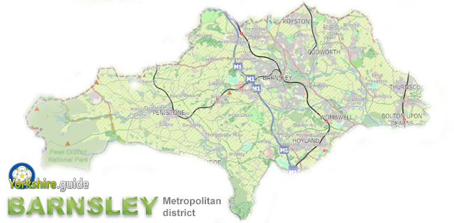 Barnsley district is one of four large metropolitan authorities which make up South Yorkshire and includes the northern part of the county, including areas of the Peak District national park to the west of the district.
As well as Barnsley itself, the metropolitan district, created in 1974, covers dozens of other towns, villages and hamlets, stretching for around 20 miles east to west and around 10 miles north to south. The total area is around 127 square miles.
The district population is over 244,600 which made it tenth-largest among 20 district authorities wholly within Yorkshire at the time of the 2021 Census. It is now eleventh after the merger of all the North Yorkshire authorities in 2023.
Barnsley district has boundaries with the three other metropolitan districts of South Yorkshire — Sheffield, Rotherham and Doncaster — as well as with the Wakefield and Kirklees metropolitan districts of West Yorkshire and with the High Peak district of Derbyshire.
Places in the Barnsley metropolitan district are:
 Ardsley Athersley Barugh Green
 Barnsley
 Billingley Birdwell Bolton upon Dearne Brierley Carlton Cawthorne Crow Edge Cudworth Darfield Darton Dodworth Dunford Bridge Elsecar Goldthorpe Great Houghton Grimethorpe Hemingfield High Hoyland Hood Green Hoyland Hoyland Common Hoylandswaine Ingbirchworth Jump Kexbrough Langsett Lundwood Mapplewell Millhouse Green Oxspring Penistone
 Pilley Royston Shafton Silkstone Silkstone Common Stainborough Tankersley Thurgoland Thurlstone Thurnscoe Wombwell
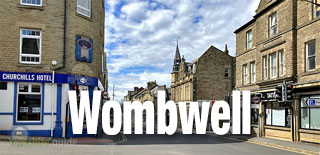 Worsbrough Wortley
We continue to add more villages to our A to Y gazetteer and the above may not yet list all places in Barnsley metropolitan district